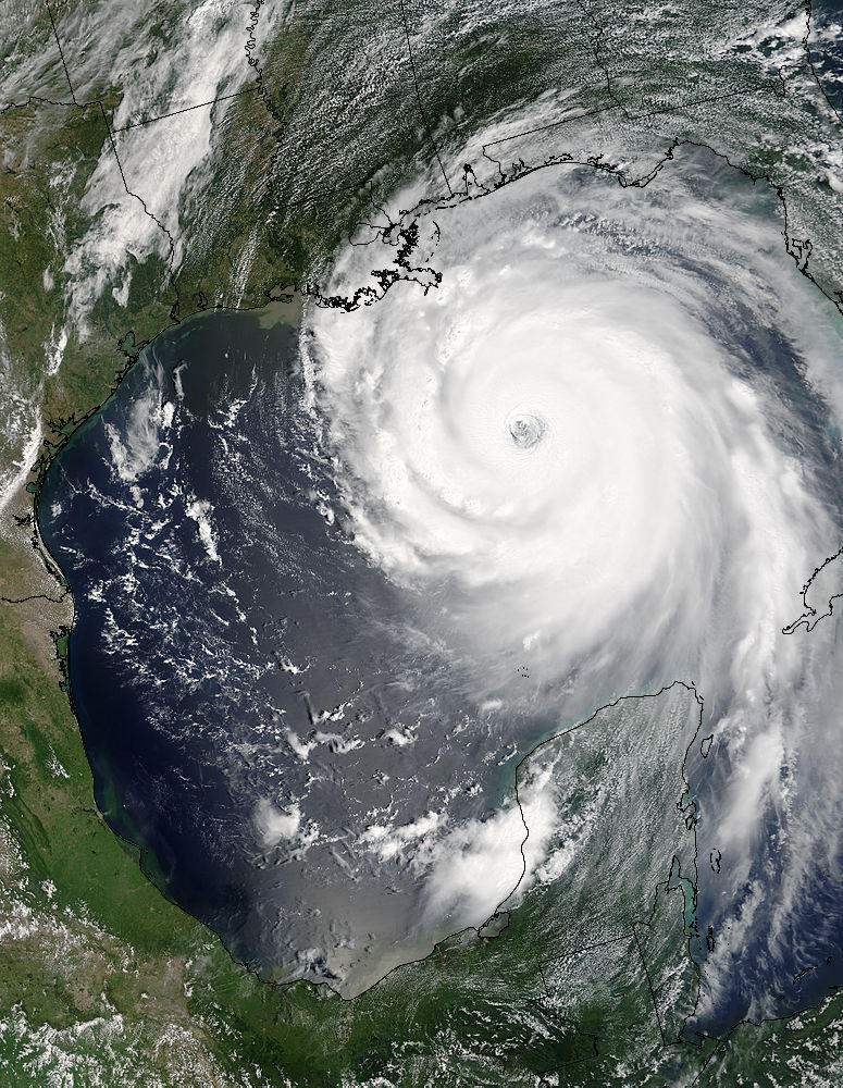
At 12:40 a.m. CDT (0540 UTC) on August 28th Katrina was upgraded to Category 4. Later that morning, Katrina went through a period of rapid intensification, with its maximum sustained winds reaching as high as 175 mph (280 km/h) (well above the Category 5 threshold of 156 mph (250 km/h)) and a pressure of 906 mbar by 1:00 p.m. CDT.
Nonetheless, on August 29th the system made landfall as a strong Category 4 hurricane at 6:15 a.m. CDT near Buras-Triumph, Louisiana with maximum sustained winds of 145 mph (235 km/h).
Hurricane Katrina is the third strongest hurricane on record to make landfall on the United States. The 15 to 30 foot (5 to 9 m) storm surge came ashore on virtually the entire coastline from Louisiana, Mississippi and Alabama to Florida. The 30 foot (10 m) storm surge recorded at Biloxi, Mississippi is the highest ever observed in America.
Picture taken on August 28th 2005 by NASA when Hurricane Katrina was near the peak of its intensity
posted by Barbara White @ 9:19 AM
0 comments
![]()

0 Comments:
Post a Comment
<< Home